Invasion: Bloody Omaha
From: Operation Report Neptune, Omaha Beach Provisional Engineer Special Brigade Group, 1944. Pp 57-58.
Description of the Omaha Beach Area (1)
701 Location and General Description
The area of operations in Normandy assigned to the Provisional Engineer Special Group extended from the beaches at the mouth of the Vire River, north of Isigny, to the boundary between the First US Army and the Second British Army, just west of Port-en-Bessin, a distance of about 12 miles (from 465906 to 7748881). The southern boundary ran from Isigny west to Trevieres and the British sector.
The focal point of this area was Omaha Beach, also known as Beach 46, where the initial V US Corps and Group landings were to take place, a 7900-yard stretch of beach backed by sandy hills (from 637929 to 697894). It ran from Pointe de la Percee to Colleville and was the only part of the coast suitable for an assault landing. The beaches at the mouth of the Vire River, backed by swampland and too far from existing roads, were not desirable for initial use, and the value of the beaches in the Grandcamp sector was limited by the Roches de Grandcamp, a series of rocky out-croppings which were covered at high water, and through which ran a single narrow channel. From Grandcamp to the western end of Omaha Beach, steep cliffs made landings almost impossible, and from the eastern end of the beach to Port-en-Bessin the same conditions prevailed, except for a small beach near the town of Ste. Honorine (2).
Omaha Beach had several advantages for an assault landing. Tides, which varied in range from 9.4 to 23 feet, uncovered an average of 300 yards of hard-packed sand which at low tide sloped gradually to a shingle pile running the length of a sandy beach 150 to 400 yards wide. Behind the beach rose bluffs and hills 100 to 125 feet high cut by five small valleys, or exits, and by minor defilades. These exits were the doors through which all troops and supplies would pass. Narrow roads with sufficiently gentle gradients for heavy traffic ran through the four western exits, designated from west to east as D-l, D-3, E-1, and E-3. The eastern exit, F-1, was little more than a slight depression in the hills, through which a steep and poorly constructed dirt road passed.
The hills behind the beach leveled out into a plateau of small farms and pastures, divided by hedgerows, bushy trees and stone fences. The land undulated in a series of small valleys and hills, finally descending into the swampy valley of the Aure River, two to four miles inland. (See Plate 3.)
Plate 3.
702 Weather (3)June weather in the Omaha Beach area is temperate, but day-to-day conditions vary greatly. Temperatures range from 42º to 85º Fahrenheit, with a mean daily maximum of 64º ; and a mean daily minimum of 54º;. The district has a fairly heavy rainfall, and, though June is a "dry" month, there is some rain on an average of 11 days, and normal precipitation is 2.1 inches. The frequency of rainfall offshore is l0%. Normal visibility is 6 to 10 miles, complete freedom from haze obtaining but 2% of the time.
The beach is exposed to winds from the northwest, north and north-east, but it was not expected that storms would seriously hamper operations in June, since winds of greater velocity than 13 miles an hour occur but 13.4 % of the time, or about five days a month, and winds of gale proportion are infrequent.
703 Oceanography (4)The surf on the beach is usually moderate, averaging less than a foot in height more than half the time. The 21st Weather Squadron estimated that a wind blowing with a velocity of 15 knots from the north for 12 hours would produce a five-foot surf, the maximum for an operational day. No more than four days in June were expected to be non-operational, although a surf of three to five feet was predicted for five to seven days.
Figures are taken from a survey, Meteorological and Oceanographic Conditions for Jun 44 in Neptune Area, Det M, 21st Wea Sq Ninth US AF, 3 May 44. Here again statistics vary slightly. See Neptune Monograph, Comdr Task Force 122, Sec II, pp 13 - 15, 21 Apr 44; Tidal Illumination Diagrams, Information Sec, Int Div, Office of the Chief Engr, European T of Opns USA, 20 Jun 44; Int Notes, Prov Engr Sp Brig Gp, 18 Apr 44.

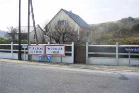
Beach view from the German side. (April,2003)
Go here for a photographic panorama view of Omaha.
Next Page. Beach obstacles.
Back to Start.